
Colorado Springs Neighbors by Record
Immediate-block research in Colorado Springs works best when each record layer keeps its own job. The city map viewer places an address on a parcel map. El Paso County Spatialest adds owner, situs, mailing, value, and building context. The recorder ties a parcel's legal description to deeds, covenants, plats, liens, and dates. Election data can provide a limited registration match, while permits and directories add time or project context. Neighborhood plans show civic geography. None of these sources is a complete roster of the people in a household. A sound block lookup records the source and the question it can answer, then stops before a clue becomes a claim.
| Source | What It Shows About a Block | Access |
|---|---|---|
| SpringsView parcels | Adjacent parcel polygons, parcel and address display, owner field, zoning, legal details, acreage, and ZIP | Free map; click or identify; no official radius roster |
| El Paso County parcel service | Nearby geometry and parcel identifiers that can be matched to an assessor record | Free REST identify or query; the service does not promise owner names |
| Assessor / Spatialest | Owner, tax-roll mailing address, situs, value, building, zoning, and legal-description context | Search each parcel; not every occupant |
| Recorder index | Ownership transfers, liens, covenants, easements, plats, parties, and recording dates | Free index; image or copy route varies |
| Colorado voter data | Public registration fields at addresses in an approved extract | Individual match or separate request; protected data withheld |
| PPRBD permits | Permit and project history tied to an address, parcel, or ZIP | Free search; plan-image access varies |
| PlanCOS and neighborhood layer | Official neighborhood-name and typology context for the mapped parcel | Planning sources; evolving geography, not a membership list |
| PPLD directories | Historical block occupants and householders for a particular year | Library collection; gaps and renumbering limits |
| CONO and plan partners | Civic connection and planning context | Current plan route; no complete public membership roster located |
The strongest current clue is usually the parcel and the owner field together. A nearby parcel can be held by a person, trust, estate, or business whose tax mailing address is elsewhere. A voter record is a match tool, not a public street or block browse. A PPLD directory entry is historical and may reflect a different street name or number. Combined carefully, the layers explain the shape and record history of a Colorado Springs block without turning distance into a relationship.
Mapping a Colorado Springs Block
The adjacent-parcel method is a controlled walk, not a radius search. Geocode the target address, note the point and ZIP, identify its polygon, then expand only to parcels that touch or sit across a road or alley. Record what the map actually displays. If the target falls outside city coverage, use the county parcel service. A road, alley, common tract, or condominium parcel can look close on screen while carrying a different legal description.
- Geocode the target address in SpringsView and save the displayed city, ZIP, point, and address form.
- Turn on Land Records, Parcels, and Parcel Labels, then identify the target polygon.
- Click or pan to each touching polygon and record the Parcel Number, Parcel Address, and displayed Owner Name.
- Compare the legal description, lot, block, subdivision, road edge, alley, common tract, or unit details before calling a parcel adjacent.
- Open each parcel in the assessor for owner and mailing context, then use the recorder for deed or relationship evidence.
Save the displayed owner name exactly as shown and keep it separate from the tax-roll mailing address. No official user-facing radius button was located. A geometry buffer or query can be performed through a REST service, but that is a GIS operation, not a turnkey Colorado Springs block search. Proximity does not establish a household, family, or civic connection.
When the question expands from the immediate block to every address along a named road, the Colorado Springs street directory provides the natural next record path for a full street-by-street chain.
Colorado Springs Parcel Map Records
Start with the address geocoder in SpringsView. Turn on Land Records, Parcels, and Parcel Labels, then use Address Points and Subaddress Points when a building has separate units. The city parcel layer can search ParcelAdr, OwnerName, and PARCEL. A result can display parcel number, parcel address, owner name, zoning, legal description, acreage, ZIP, hyperlink, and geometry. SpringsView's geocoder also returns a default address, street, city, ZIP, ZIP4, state, coordinates, and distance. It locates the point; it does not replace the owner record.
The El Paso County parcel map service gives a county geometry view for comparing touching polygons when the city layer does not cover the needed parcel.
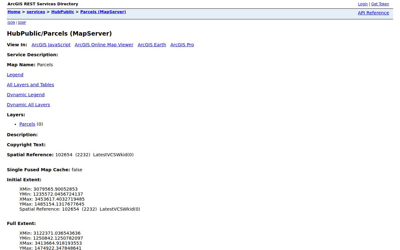
The county service supports identify and query and has a 2,000-record service limit. The city layer has an observed maximum of 500. Neither limit describes the number of people in a block, and county geometry may need to be matched to the parcel hyperlink or the PARCEL value in the assessor system.
Note: A map service can show touching geometry, but it cannot turn a block into a complete household list.
Assessor Cards for Colorado Springs Neighbors
El Paso County's Spatialest property search accepts Schedule or Parcel Number, Address, and Owner Name. Results can be sorted by schedule number, address, or owner name and viewed in list, grid, or map form. The inspected result set is capped at 300. For a block lookup, search each parcel separately and preserve the distinction between the card's owner, Location or situs, and Mailing Address.
- Owner
- The name listed for the assessed parcel. Business, trust, and estate styling may differ from a personal name.
- Location or situs
- The parcel's physical address. It is the useful address key for matching the map and recorder records.
- Mailing Address
- The tax-roll contact address. It may belong to a bank, trust, attorney, former address, or an out-of-county contact.
- Legal description
- The land description that bridges the parcel card to deeds, plats, lots, blocks, and subdivisions.
- Building and value fields
- Market and assessed values, land and building characteristics, zoning, and taxing entities describe the parcel or structure, not every person using it.
The El Paso County Assessor property search is useful for the owner-to-parcel step, but the card does not promise a household list. A mailing address outside the parcel is a reason to label the field precisely, not to rewrite it as a residence.
Note: An assessor result can identify an assessed owner and parcel relationship without proving who currently stays at that location.
Colorado Springs Neighbors in PlanCOS
Parcel geometry answers where land sits; neighborhood planning adds the civic language used around it. The Colorado Springs Neighborhood Planning Program works through six council districts and plan areas. PlanCOS names places such as Rockrimmon, Mountain Shadows, Holland Park, Cedar Heights, Garden Ranch, Old North End, Old Colorado City, Westside, Middle Shooks Run, Downtown, and East Lake. Those names and typologies are evolving planning constructs, not strict legal boundaries or public resident rosters.
The Colorado Springs Neighborhood Planning page is the current route for plan-area information and local context.
The planning layer can help explain why two nearby parcels are described with different local terms. It cannot confirm association membership. For southeast research, the named plan areas include Deerfield Hills, Pikes Peak Park North and South, Soaring Eagles, Southborough, and Spring Creek, with community partners identified through the plan materials.
Use the current plan wording beside the parcel address, and do not treat a planning label as proof that everyone nearby belongs to one organization.
Deed Clues for Colorado Springs Neighbors
Once parcel numbers and legal descriptions are saved, the El Paso County recorder can add documentary evidence. Its real-estate index is party and instrument keyed, rather than a clean address history. In the El Paso County Real Estate Search, start with the current owner as Grantee, choose a deed type such as Warranty Deed, Quit Claim Deed, Deed-Other, or Public Trustee Deed, and narrow the date range. A likely purchase instrument can show grantor, grantee, legal description, recording date, instrument number, and image availability.
| Deed | Evidence of a recorded transfer between parties, tied to a legal description and recording details. |
|---|---|
| Deed of trust | Financing evidence, not by itself proof of a transfer or occupancy. |
| Covenant or easement | A recorded land or use document that may touch several lots without naming a household. |
| Plat | A recorded map that can show lots, blocks, streets, alleys, easements, and common tracts. |
To move backward, copy the seller or grantor from the likely deed and search that party as a prior grantee. Validate the same lot, block, subdivision, or metes-and-bounds description at each step. The recorder offers a free index but does not perform a title search. Images may require remote access or a copy request, and a documentary chain is not a legal title opinion.
Colorado Springs Address Records and ZIPs
The Pikes Peak Regional Building Department advanced search adds project context to a parcel. It accepts address, parcel, permit, plan, and five-digit ZIP inputs, along with jurisdiction, project type, issued-date ranges, status, discipline, project description, and valuation. Results can show permit or project dates, jurisdiction, status, discipline, description, valuation, and links to plan or card images. A permit applicant or contractor is a project-party clue, not a current resident result.
City projects route through PPRBD, while the El Paso County planning dashboard is for active or approved applications in unincorporated county areas. A ZIP search can cross jurisdictions. SpringsView's ZIP layer also contains nearby or outlying values such as 80132, 80809, 80817, 80819, 80829, 80831, and 80840, so a map result should not be read as a city-limit decision.
The PPRBD advanced permit search can confirm a project record for an address. When a parcel, tax record, and mailing label disagree, use the USPS ZIP lookup for the current delivery result. USPS treats ZIP Codes as delivery geography, not a municipal boundary.
Note: A ZIP result supplies delivery context, so it should not be treated as proof that an address lies inside Colorado Springs city limits.
Civic Connections for Colorado Springs Neighbors
A civic directory layer exists, but it is not a complete public association list. The city's planning materials identify plan areas and community partners. CONO, described in a city resolution, serves as a Pikes Peak regional umbrella that connects and educates neighborhoods and represents common needs. The research did not locate a complete official directory of every association, private membership list, or block-watch roster.
The PlanCOS neighborhood framework shows why the local label should be checked against current planning material before it is used as a boundary claim.
The framework image is useful for orientation, while the current plan page is the better source for wording and updates. A plan name can help a reader find a civic contact without implying that a parcel owner, voter, or occupant belongs to that group.
Neighborhood Planning
Current plan areas and district context.
Use the current planning page for updates.
PlanCOS Framework
Neighborhood names and evolving typologies.
Use the framework reference for updates.
These routes are a way to verify current civic context, not a substitute for a private roster. Ask the current plan or organization for its own boundary and contact rules rather than relying on an old third-party entry.
Privacy Limits on Colorado Springs Neighbors
Public block records leave important gaps. Non-owner occupants and other household members are not listed in a universal public parcel layer. DMV address information is restricted by the Driver's Privacy Protection Act, 18 U.S.C. §§2721-2725. Utility customers, delivery records, unlisted phone information, private association rosters, and protected Address Confidentiality Program addresses are not public neighborhood fields.
Colorado voter data has a narrower public split. Full name, residential address, party affiliation and date, optional phone and gender identity, birth year, and prior-vote information may be public. The web lookup requires first name, last name, ZIP, full birthday, and reCAPTCHA for an individual match. It does not offer a block browse. A separate county or state extract follows its own request process, confidential voters and ACP participants are excluded, and ballot choice remains secret.
| Source Type | Useful Clue | Boundary |
|---|---|---|
| Official parcel and assessor records | Parcel shape, listed owner, mailing field, legal description, and property context | Not every occupant; mailing address is not silently a residence |
| Recorder and permit records | Transfers, recorded land documents, project history, and dates | Documents do not create a household roster |
| Public voter data | Limited registration fields when an individual match or approved extract is available | No public block browse; protected fields and ballot choice remain closed |
| Commercial block-search tools | May combine public and older address clues in one paid profile | Source age, cost, errors, and lawful-use limits vary; verify with the custodian |
The Colorado Address Confidentiality Program uses a substitute address and masks an ACP participant's actual address, county, and precinct. Colorado's stalking and harassment statutes, C.R.S. §§18-3-602 and 18-9-111, also matter when a public record is used to monitor, intimidate, or repeatedly contact someone. A record can be public and still be unsafe to republish.
Lawful use. Colorado Springs block lookups are appropriate for personal, lawful research, civic curiosity, family history, or personal safety awareness. Repeated monitoring, intimidation, stalking, harassment, or harm is not a lawful use, and public availability does not remove those limits.