
Walking a Colorado Springs Street by Address
A street directory works best as a chain of keys, not as one master list. Start with the address as it is used for mail, then compare it with the Colorado Springs geocoder, the city parcel layer, and the El Paso County parcel service. The mapped point leads to a parcel number. The parcel leads to an assessor card, where the owner, tax mailing address, situs, legal description, and building facts are kept together. From there, the recorder supplies recorded instruments, while permits, voter records, and older directories add separate clues.
That order keeps the street-by-street search grounded. A name that appears on a deed is a party to an instrument, not proof of a current household. A tax mailing address may belong to a representative or sit outside Colorado Springs. A directory entry is tied to its publication year. Use each record for the question it can answer, and keep the source and date with every note.
- Normalize the address in SpringsView and save the returned street, city, ZIP, point, and distance values.
- Run the address in the El Paso County Assessor property search, then record the parcel or schedule number, owner, situs, mailing address, and legal description.
- Open the city or county parcel map and click the target polygon and the touching polygons, keeping parcel labels separate from any inference about people.
- Use the recorded owner as a grantee in the deed index, read the seller as grantor, and search that seller as a prior grantee to move backward.
- Use the voter match form for a named person and the PPLD street guide or householders-by-street pages for historical households, since neither is a public whole-street browse.
Normalize a Colorado Springs Street Address
Colorado Springs is the county seat and lies wholly within El Paso County, so city and county systems overlap while still using different keys. Colorado Springs has three address identities that must stay distinct: a USPS delivery address, a municipal or county situs address, and a parcel legal description. SpringsView's Address Search can return default_address, Street, City, ZIP, ZIP4, StateAbbr, X, Y, and Distance. Those values help resolve a spelling or point, but the geocoder is not an ownership record. Unit labels and subaddresses can split one building into separate map features.
After the point is set, check the city Land Records service for Address Points, Subaddress Points, Parcel Labels, and Parcels. If a point falls outside that city layer, use the county GIS service and check the PPRBD jurisdiction. PPRBD serves Colorado Springs and El Paso County, while the county planning dashboard is for unincorporated applications. A ZIP can cross the city line, so keep the delivery ZIP, legal municipality, and parcel jurisdiction in separate fields.
Address terms.
- Parcel
- A mapped land unit with a county identifier, assessment record, and geometry.
- Situs address
- The physical location tied to a parcel, distinct from its tax mailing address.
- Plat
- A recorded land plan that can show lots, blocks, streets, alleys, and easements.
- Criss-cross directory
- A reverse street method that starts with an address; local volumes provide this tool after 1900 through street cross-references.
Note: A matched address is a starting key; preserve the original wording when an older deed, plat, or directory uses another form.
Read Colorado Springs Assessor Cards
The Spatialest property search is the main current parcel entry point for Colorado Springs and El Paso County. Its three primary searches are Schedule or Parcel Number, Address, and Owner Name. An assessor neighborhood selector is also available. Results can be sorted by Schedule No, Address, or Owner Name and shown as a list, grid, or map. The inspected result limit is 300.
The card is rich, but its fields answer property questions rather than proving who sleeps at a situs. It can show Owner, Mailing Address, Location or situs, Tax Status, Zoning, Plat No, Legal Description, market and assessed values, land and building facts, taxing entities, and links for sales, deeds, sketches, or images. Mailing Address is not situs occupancy proof. An LLC, trust, estate, bank, or out-of-county contact can receive tax mail for a Colorado Springs parcel.
| Field or result | Kind | What it contributes | Limit to keep |
|---|---|---|---|
| Schedule / Parcel Number | Search field | Permanent county parcel key | Use the suggested value when available |
| Address | Search field | Situs-based address match | Normalize directional and street-type spelling |
| Owner Name | Search field | Name index for an owner record | Business and trust styling may differ |
| Neighborhood | Selector | Assessor neighborhood option | Not a household roster |
| Sort and layout | Control | Schedule No, Address, Owner Name; list, grid, map | Does not promise a whole-street export |
| Owner and Mailing Address | Result card | Listed owner and tax correspondence address | Mailing address is not situs occupancy proof |
| Location, Plat No, Legal Description | Result card | Physical parcel and recorded land description | Use the legal description to bridge to deeds |
| Values, land, building, zoning, taxing entities | Result card | Assessment and built-environment context | These facts do not list all people using the parcel |
| Sales, deed, sketch, and image links | Result links | Routes to related property evidence | Verify legal instruments in the recorder index |
The assessor office is at 1675 W. Garden of the Gods Road, Suite 2300, Colorado Springs, CO 80907. Staff can be reached at 719-520-6600 or asrweb@elpasoco.com, Monday through Friday from 8:00 to 4:30. The El Paso County Assessor office page is the right fallback when a portal match needs clarification.
The assessor's legal-description material covers rectangular survey, metes-and-bounds, and recorded-plat descriptions. A parcel ID connects the assessment record to maps and the tax roll, but the legal description remains the stronger bridge to the recorder.
The assessor screenshot at the official Spatialest search shows the address, owner, and parcel search modes used for a Colorado Springs street directory.
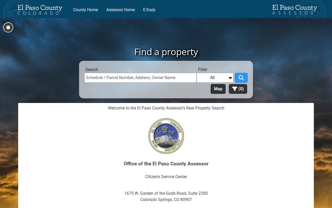
The visible modes make an address-to-parcel pass possible, while the card fields supply the details that must be checked against other record keepers.
Map Colorado Springs Parcels Along a Street
The El Paso County Parcels MapServer supports identify, query, and find controls with JSON, GeoJSON, and PBF output. Its parcel layer exposes OBJECTID, PARCEL, HYPERLINK, InPoly_FID, Shape__Area, and Shape__Length. The service has a 2,000-record limit. It is a geometry and parcel-ID service, so an owner name should be confirmed through the assessor rather than assumed from a map link.
For a Colorado Springs parcel, the city Land Records MapServer adds Address Points, Subaddress Points, Parcel Labels, and Parcels. Its parcel search fields include ParcelAdr, OwnerName, and PARCEL. Displayed fields include Parcel Number, Parcel Address, Owner Name, zoning, legal description, acreage, ZIP, geometry, and a hyperlink. The observed city limit was 500 records. Pan along a street and identify each touching polygon, but do not call the result a resident radius list. No official radius button was located.
The county parcel image comes from the official El Paso County map service.
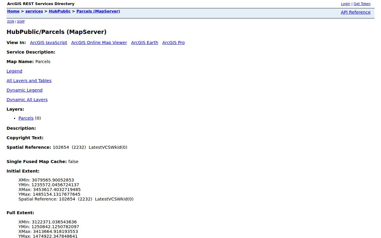
Use the parcel view to expand from one address to the block, then return to the assessor and recorder for owner and instrument details.
Colorado Springs Street Records at a Glance
Each record set uses a different key. The coverage table keeps the current Colorado Springs street directory trail honest by showing what can be searched, what the result means, and where the fallback lies when an online view is limited.
| Record set | Address key | What it can show | Access and boundary |
|---|---|---|---|
| Assessor parcel card | Address, owner, parcel | Owner, mailing and situs fields, values, building, zoning, legal description | Free Spatialest search; office fallback |
| City Land Records | ParcelAdr, OwnerName, PARCEL | Parcel and address points, labels, owner display, legal and geometry | Free SpringsView and REST layers; city limit |
| County parcel service | PARCEL and geometry | Adjacent polygons, parcel IDs, map hyperlink, area and length | Free identify/query; owner link may require assessor |
| Recorder index | Party, legal description, instrument | Deeds, liens, plats, easements, covenants, parties, dates | Free index; remote images and copy route vary |
| PPRBD permits | Address, parcel, ZIP, permit, plan | Project, status, discipline, description, valuation, plan/card links | Free search; some plan images need an account or subscription |
| PPLD directories | Street guide and householder address | Historical names, occupations, addresses, and block order | Library, digitized volumes, staff-assisted archives; gaps apply |
| Voter information | Name, ZIP, full birthday | Public registration fields and election participation fields | Individual match or separate data request; protected records withheld |
| Census records | Enumeration address | Household snapshot at the census date | Federal release rules and historic boundary limits |
The street name is only the shared surface. The parcel number joins assessment and map work; the legal description joins the recorder; the person match joins voter data; the year joins a directory or census entry. A clean result keeps these keys in separate notes rather than flattening them into one household claim.
Trace a Colorado Springs Street Through Deeds
The El Paso County recorder real-estate index is party and instrument keyed, not a ready-made address history. Begin with the current assessor owner and legal description. In General search, use Party Name, set Party Type to Grantee, choose a likely deed type, and narrow the date range. The form also supports separate Grantor and Grantee roles, Both or Grantor or Grantee party type, instrument number, book and page, document type, subdivision, condominium, section, range, township, and survey terms.
Common document labels include WARRANTY DEED, QUIT CLAIM DEED, DEED-OTHER, PUBLIC TRUSTEE DEED, liens, easements, plats, and covenants. Read the likely purchase instrument for the seller, recording date, instrument number, book or page, legal description, and image route. Then search the seller as the prior grantee. The working chain is address → current owner → grantee deed → seller/grantor → prior grantee. Confirm lot, block, subdivision, or metes-and-bounds language at every turn. A deed of trust is financing evidence, not automatically a transfer.
The index is free, but the county does not perform a title search. Permanent real-estate indexing was observed from January 1, 1980 to the current date, with temporary current-day indexing. Images were observed from 1980; routine remote images are generally 1996-present, with older back-images being imported. The main recording office is at 1675 W Garden of the Gods Road, Colorado Springs, and can be reached at 719-520-6200 or recweb@elpasoco.com, Monday through Friday from 8:00 to 4:30. Pre-1996 copy needs route through the Citizens Service Center.
The recorder search image is linked from the official real-estate index.
That form is most useful after an assessor card supplies a name and legal description, because the recorder's own index does not promise a complete street-by-street household roll.
Check Colorado Springs Permit History by Address
The Pikes Peak Regional Building Department advanced search adds work history to a Colorado Springs street directory trail. Its controls can use address, parcel, permit, plan tracking, conveyance IDs, ZIP, jurisdiction, project type, issued-date ranges, status, discipline, description, and valuation. Participating jurisdictions include Colorado Springs and El Paso County. The search is free.
PPRBD results can point to permits, inspection or project history, and plan or card images. Some plan images use an account or subscription route beginning at $19.95. The office is at 2880 International Circle, Colorado Springs, and its phone is 719-327-2880. A permit names a work event, applicant, contractor, or project contact as shown in the record. It is a clue about a building or parcel, not a current resident list. Planning applications for unincorporated El Paso County use a separate dashboard, while city permitting routes to PPRBD.
Note: A permit can date construction or alteration work, but it cannot establish that the named applicant lived at the Colorado Springs address.
Read the Colorado Springs Historical Street Layer
The Pikes Peak Library District house-history guide gives Colorado Springs street work a useful historical layer. PPLD holds city directories from 1879 to the present, with digitized Colorado Springs volumes from 1879-1929 and gaps. After 1900, many volumes include a street cross-reference. The 1904 directory is especially suited to a block walk because it contains historical and miscellaneous pages, a street guide, an alphabetical directory, a classified business section, and householders arranged by streets.
The 1904 front matter reports about 14,947 Colorado Springs names or entries. That is a directory-entry count, not a population count and not proof of present residence. Use the street guide to locate an address, then check the alphabetical pages for a name and occupation. The householders-by-street pages can show the order of a block, while initials, widow or widower notes, boarding-house language, and abbreviations need care. Separate reverse volumes were not confirmed in official PPLD descriptions, so describe the local tool as a reverse or criss-cross feature inside the directories.
For the historical collection route and entry-reading details, use the Colorado Springs city directory page. The PPLD house-history guide points to the Regional History & Genealogy room, digital collections, and staff-assisted archival pulls.
Follow Colorado Springs Street Names Through Time
Old Colorado City and the Westside create a local search trap. PPLD records street-name changes and odd or even number changes across the 1870s-1917 period. Colorado City was annexed to Colorado Springs in 1917, and the city expanded westward in 1890. A directory may therefore name Colorado City, use an earlier street name, or assign a number that does not fall on the modern geocoder in the way a researcher expects.
When a historic Colorado Springs address seems to vanish, compare the directory street guide with a recorded plat, legal description, Sanborn sheet, parcel geometry, and the city's annexation history. Colorado Springs history materials place the 1890 and 1917 changes in context. Keep the old wording in the search notes. Replacing it too soon can erase the very clue that connects an older household entry to a current parcel.
Use Colorado Springs Voter Data With Care
The Colorado Secretary of State voter lookup is an individual match form, not a public Colorado Springs street browse. It requires first name, last name, ZIP, full birthday in MM/DD/YYYY form, and reCAPTCHA. The form advises using the name as registered and contacting the county when a match fails. Confidential voters, some under-18 records, and records protected by program rules may not appear.
Public voter fields can include full name, residential address, party affiliation and date, optional phone and gender identity, birth year, and prior-vote information. Confidential fields include Social Security number, driver-license number, month and day of birth, signature, and email. Ballot choice is not public. A separate bulk request exists through the Secretary of State, and the El Paso County Elections office handles countywide list or export questions. Voter data can add a named confirmation clue, but it cannot prove that every person at an address is registered there.
Colorado Springs voters who face criminal-harassment or bodily-harm risk can use the county confidentiality process, and Colorado Address Confidentiality Program participants have a substitute address with the actual address, county, and precinct masked. The public voter form is therefore a narrow match tool, not a full street directory.
Limits of the Colorado Springs Street Directory
A street directory can show a listed owner, a tax mailing address, a parcel shape, a recorded party, a permit event, a historical householder, or a named voter match. It cannot turn those separate fields into a complete list of current occupants. Property data does not list every non-owner occupant or household member. Utility customer names, delivery records, unlisted phone data, private association rosters, and protected ACP addresses are not public street layers.
The federal Driver's Privacy Protection Act, 18 U.S.C. §§2721-2725, restricts DMV personal information. Colorado vital, court, voter, and recorded-document rules also remove or protect some fields. The Colorado Privacy Act does not create a universal deletion button for a county assessor, recorder, court, voter roll, or vital record. Ask the responsible custodian about a correction, confidentiality, or redaction route, and do not publish protected identifiers seen in an old image.
Lawful use. Colorado Springs street and address records may support a lawful personal, property, genealogy, civic, or safety question. C.R.S. §§18-3-602 and 18-9-111 address stalking and harassment. Do not use a record to stalk, harass, intimidate, or publish a protected address.
The safest result is a narrow, sourced answer: name the custodian, keep situs and mailing fields distinct, cite the record date, and stop when the record no longer supports the question. A lawful street search respects both the public record and the person behind it.