
Colorado Springs ZIP Codes by Delivery Area
The Colorado Springs ZIP code directory needs two source layers. The city’s ZIP-code GIS layer shows spatial values, while the USPS ZIP basics explains delivery geography, standard and unique ZIPs, ZIP+4, and delivery units. The table uses representative Colorado Springs codes from both routing contexts. Its area descriptions are practical cues for sorting a search, not a statement that the five-digit code follows the city line.
| ZIP | Areas Covered | Post Office | Notes |
|---|---|---|---|
| 80903 | Downtown and central Colorado Springs | Colorado Springs Main Post Office, 201 E. Pikes Peak Ave., 80903-9900 | Spatial city GIS value; verify a particular address |
| 80904 | Westside, Old Colorado City, and west-central areas | Verify the current station through USPS | Spatial city GIS value; station assignment is not assumed |
| 80905 | Southwest and central-south Colorado Springs | Cheyenne Mountain station listing uses 80905-1933 | Spatial city GIS value; use live lookup for delivery |
| 80906 | Broadmoor and Cheyenne Mountain corridor | Verify the current station through USPS | Spatial city GIS value |
| 80908 | Northeast, east-northeast, and county-edge development | Verify the current station through USPS | Spatial value that can cross simple city assumptions |
| 80911 | Security, Widefield, and south county delivery area | Verify the current station through USPS | Spatial value includes non-city county geography |
| 80913 | Fort Carson, south installation, and nearby county context | USPS verification required | Installation and unique-delivery details need a live result |
| 80920 | North and northeast Colorado Springs | Verify the current station through USPS | Spatial city GIS value |
| 80925 | South county growth area | Verify the current station through USPS | Spatial value; not all mapped land is city proper |
| 80938 | Northeast and east Colorado Springs | Verify the current station through USPS | Spatial city GIS value |
| 80939 | Installation or special east and south-side routing | Verify the current USPS city and station label | Spatial value with special-delivery context |
| 80951 | Southeast and east county edge | Verify the current station through USPS | Spatial value; county-edge geography |
| 80901 | Central Colorado Springs special mailing context | USPS routing lookup | Special or PO-style code; not a normal city parcel polygon |
| 80840 | United States Air Force Academy delivery context | USPS verification required | Nearby installation value in the city GIS layer |
| 80132 | Monument and north county edge nearby | USPS routing lookup | Spatial value in the city layer, not Colorado Springs municipal geography |
The complete routing set is broader than these rows. The research also identifies spatial values from 80903 through 80911 and 80913 through 80930, plus 80938, 80939, and 80951, along with many PO, special, military, and historical codes. For a letter, parcel, tax account, or old directory entry, preserve the exact code and the date attached to it. The Colorado Springs main post office listing confirms the central counter address, but it does not assign every local address to one station.
Note: The rows are geographic cues, not legal boundaries; a current USPS result controls a particular address and delivery label.
Colorado Springs Spatial ZIP Map
The Colorado Springs GIS layer returned spatial values 80903 through 80911, 80913 through 80930, 80938, 80939, and 80951 during inspection. It also returned nearby or outlying values such as 80132, 80809, 80817, 80819, 80829, 80831, and 80840. That result is useful for a map-based ZIP code directory because it shows where polygons touch the city’s working geography. It is not a complete USPS list, and it does not prove that every polygon sits inside Colorado Springs limits.
The parcel view adds a second layer. El Paso County’s parcel MapServer supports identify and query controls and returns parcel geometry, a parcel identifier, hyperlinks, and shape fields. It does not promise owner names by itself. Match its parcel value to the assessor, then retain the source and observation date. SpringsView is the more person-facing map: its address search can return an address, street, city, ZIP, ZIP+4, state, coordinates, and distance, while its parcel layer supports ParcelAdr, OwnerName, and PARCEL searches.
The El Paso County parcel map service supplies the geometry context used when a Colorado Springs ZIP appears to cross a parcel or jurisdiction line.
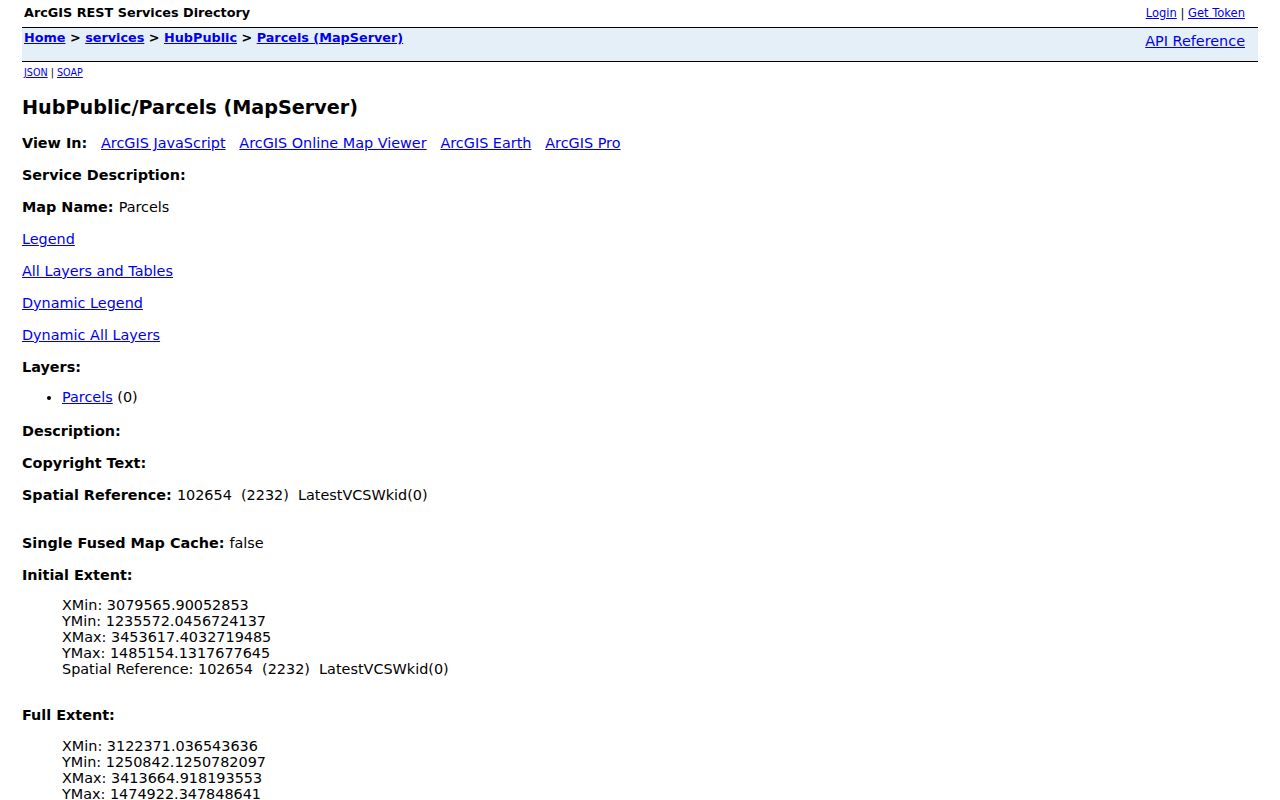
Parcel geometry can show why a ZIP search touches county-edge land, but ownership and residence still require the right custodian and record type.
USPS ZIP Lookup Modes for Colorado Springs
USPS treats a ZIP code as delivery geography rather than a municipal boundary. The city name printed in an address can be the name used by a delivery unit, not the legal name of the municipality. A standard ZIP serves a delivery area, while a unique ZIP can serve one institution or organization. ZIP+4 narrows the five-digit route to a smaller delivery unit. When a Colorado Springs address, city label, and ZIP disagree, USPS points users to its AIS Viewer, the local post office, and the current lookup tool.
| USPS mode | Enter | Best use | Important limit |
|---|---|---|---|
| By Address | Company, street, unit, city, state, urbanization code, optional ZIP | Check one Colorado Springs delivery address | The result verifies mail routing, not a person or company |
| By City & State | City and state | List ZIPs tied to a delivery-city label | The delivery city may not be a municipal boundary |
| Cities by ZIP | Five-digit ZIP | See city names connected to a code | It does not produce a resident list |
The USPS ZIP Code Lookup shows the live address, city-state, and ZIP-to-city paths described above.
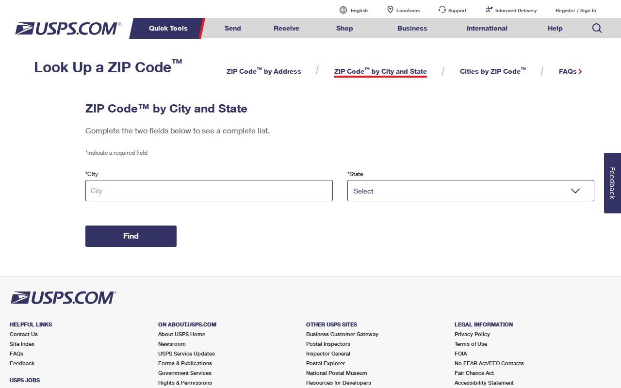
The lookup view is the final mailing check before an older directory, county tax record, or Colorado Springs GIS result is compared with a current ZIP.
USPS warns that a returned ZIP does not prove that a person or company is located at the address. That warning matters in any Colorado Springs residents directory workflow. A ZIP result can resolve a mail label, help group a parcel search, or explain a city-name mismatch. It cannot turn a delivery area into a household roster.
Finding Colorado Springs Residents by ZIP Code
A ZIP code search works best as a narrowing step. It can sort a Colorado Springs records trail by delivery area, but each portal uses a different key. Use the postal tool first when the address itself is uncertain, then compare the ZIP with a map, property record, tax account, or individual voter match. Keep owner, mailing address, situs address, and registered voter status separate.
- Start with the USPS By Address mode when a street and unit are known. Record the returned five-digit ZIP, ZIP+4, city label, and the date of the check. If only a city and state are known, use By City & State; if only a code is known, use Cities by ZIP.
- Open SpringsView and use its ZIPCODE layer to see the mapped area, then inspect an address or parcel. The county parcel service can add geometry and jurisdiction context, but neither map is a complete resident list.
- Use the ZIP-capable local records portals with care. PPRBD accepts a five-digit ZIP for permit and plan searches, while the treasurer portal displays ZIP among its available fields without making it an active default browse mode.
- For one person, use the Colorado voter form only when the first name, last name, ZIP, full birthday, and reCAPTCHA are available. A failed match can reflect spelling, timing, confidentiality, age, or a changed ZIP; the form has no street-only or browse-by-ZIP mode.
- Date the result and move to the appropriate record keeper. When a ZIP narrows the question to a particular street, the Colorado Springs street directory supplies the street-level path.
The state voter form is a name match, not a ZIP-wide directory. Its public fields can include name, residential address, party affiliation and date, supplied phone or gender identity, birth year, and prior-vote information. Social Security numbers, driver-license numbers, month and day of birth, signatures, and email addresses are confidential. Protected voters may not appear. For broader extracts, the Colorado Secretary of State elections data request and the El Paso County Elections office are separate access channels.
That distinction keeps a Colorado Springs ZIP code directory useful without overstating what a ZIP can show. It is a way to group and verify records, not a shortcut around the source office’s rules.
Note: A voter ZIP is an input for one-person matching, not a public result list that can be browsed block by block.
El Paso County ZIP Search Portals
Local Colorado Springs and El Paso County portals accept ZIP in different ways. A searcher who treats every ZIP box as a resident index will read the result too broadly. The PPRBD advanced permit search supplies the clearest captured field set for a ZIP-capable local search, while the other portals use ZIP as a map or one-person matching clue.
| Field or control | Type | Required | Options or format notes |
|---|---|---|---|
| Search By | Radio/tab | Yes | By Address, Location, Master Model Number, Parcel Number, Permit Number, Plan Tracking Number, Conveyance State ID, or Conveyance Serial Number |
| Lowest / Highest Street Number | Numeric text | Address mode | Optional range; a highest number can help with a multi-address search |
| Direction | Dropdown | No | Blank, E, W, N, or S |
| Street Name | Text | Address mode | Maximum 30 characters; leave off directional prefixes and street designations |
| Street Type | Dropdown | No | Examples include ALY, AVE, BLVD, CIR, CT, DR, LN, PKWY, RD, ST, TER, TRL, WAY, and XING |
| City | Dropdown | Address mode | Includes Colorado Springs, El Paso County, Fountain, Manitou Springs, Monument, Palmer Lake, Woodland Park, and other listed service communities |
| ZIP | Text | Advanced address mode | Maximum five digits |
| Jurisdiction | Dropdown | No | All, Colorado Springs, El Paso County, Calhan, Fountain, Green Mountain Falls, Manitou Springs, Monument, Palmer Lake, or Woodland Park |
| Project Type | Dropdown | No | Single Family, Multi Family, Residential Alt, Residential CO, New Commercial, Commercial Alt, Commercial CO, or All Other |
| Issued Date | Dropdown/date pair | No | Preset ranges or Custom Range using MM/DD/YYYY |
| Result filters | Tabs/controls | No | Permits, Plans, Archived Permit Cards, status, discipline, description, and valuation filters |
| Buttons | Buttons | Run or clear | Search for Permits; Clear |
PPRBD serves Colorado Springs and several participating jurisdictions, so a ZIP result can cross a municipal or county context. The search is free, but some plan images have account or subscription limits. SpringsView uses the ZIPCODE map layer and address, parcel, and neighborhood tools; it has no official ZIP-wide household roster or radius button. The assessor search has no normal ZIP browse. The treasurer search displays ZIP Code, but Account Number, Name, and Address were the active default choices. The voter form requires ZIP for a named match and offers no ZIP browse.
The Spatialest assessor search is the strongest owner and parcel starting point, even though it does not offer a normal ZIP field. A result card labels the mailing address, situs or location, zoning, plat, legal description, parcel number, tax status, values, taxing entities, and sales-history or deed links. A mailing address may belong to a bank, trust, attorney, former address, or an address outside the county. It must stay labeled as a tax-roll mailing address.
The assessor search screenshot shows the owner-name, address, and parcel-centered choices that make a ZIP-wide search indirect.
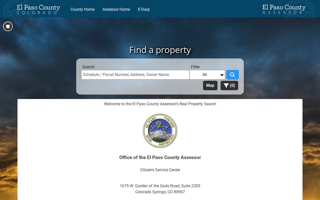
Use the property result to identify a parcel, then compare the parcel’s ZIP with USPS and the mapped layer instead of treating the owner card as a household list.
The treasurer’s field set includes Account Number, Secondary ID, Name, Address, and ZIP Code. During inspection, Account Number, Name, and Address were the active default search choices. Registration adds account history, autopay, and notifications, while a one-time search or payment can be made without registration. A tax account gives tax context only.
The El Paso County Treasurer tax-search group shows how ZIP is available without becoming a ZIP-wide resident search.
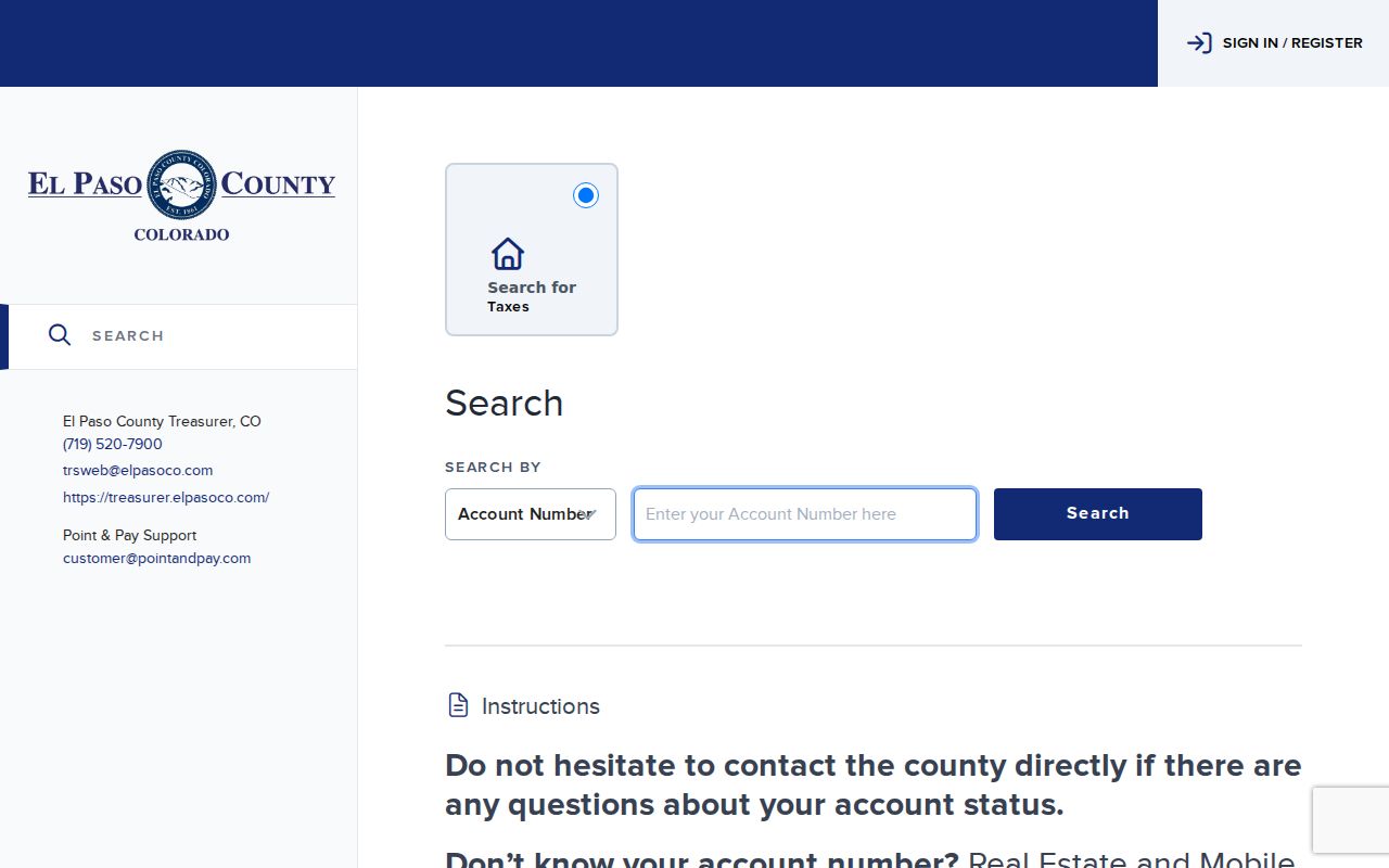
Tax records can help connect an account to an address, but a tax payment, delinquency, or certificate does not establish who occupies the property.
Colorado Springs ZIP Relabeling in 2026
Historical ZIP research needs a date. The official Postal Bulletin 22698 records April 2026 relabeling context for 80935, 80941, and 80995, associating those former or special labels with 80910-related routing. The USPS DMM L012 file effective July 1, 2026 is the current routing and label reference used alongside that bulletin.
An old Colorado Springs letter, directory page, tax record, or envelope may retain one of those codes. That does not make it a current residential polygon. Preserve the historical code, source date, and original city label, then run the live USPS address lookup before assigning a present-day delivery area. This is especially important when a special, PO, administrative, or installation code appears beside a person’s name.
Date the code. A historical ZIP can explain an old record without proving that the same code still describes the parcel or delivery route.
Nearby ZIPs in Colorado Springs GIS
The Colorado Springs spatial layer includes nearby or outlying values that widen the map beyond the city’s ordinary address assumptions. The research identifies 80132 near Monument and the north county edge; 80809 near Pikes Peak and Cascade; 80817 near Fountain and Security; 80819 near Cascade and Green Mountain Falls; 80829 near Manitou Springs; 80831 near Peyton and the east county; and 80840 for the United States Air Force Academy. These are map observations, not a claim that each area is part of Colorado Springs.
County-edge, mountain, rural, and installation geography can make a Colorado Springs ZIP search look inconsistent across portals. SpringsView may show the ZIP polygon, the county parcel service may show a parcel geometry, and USPS may return a delivery-city label that differs from the legal municipality. The city’s neighborhood planning labels add local context, but evolving neighborhood names are not strict legal boundaries. Keep the ZIP, municipality, jurisdiction, and parcel identifiers in separate notes.
Note: A nearby code in a city GIS layer should prompt a jurisdiction check, not an assumption about Colorado Springs residency.
Colorado Springs ZIP Code and City Limits
Colorado Springs addresses have three related but different identities: the USPS delivery address, the municipal or county situs address, and the parcel’s legal description. The city geocoder can normalize an address to a point and ZIP. A parcel layer can return ParcelAdr, PARCEL, and OwnerName. The assessor can show tax situs and mailing address. The recorder uses legal descriptions and party or index terms. One street number can therefore point to a different unit, subdivision, jurisdiction, or parcel in each system.
- ZIP code
- A five-digit USPS delivery geography used to route mail. It is not a legal city boundary.
- ZIP+4
- The four-digit extension added to a five-digit ZIP to narrow the delivery route or unit.
- PO-box ZIP
- A ZIP used for post-office boxes or a special mailing context rather than a normal residential parcel polygon.
- Unique ZIP
- A code assigned to one institution or organization, with current use confirmed through USPS.
- Carrier route
- A smaller delivery grouping within ZIP service geography. It is a mail-routing concept, not a public household roster.
USPS can return a delivery-unit city name that is not the legal municipality. The city GIS layer can include county-edge and nearby values. The assessor may list an owner and a mailing address that do not match the situs. A treasurer account can show a ZIP without making it an active browse field. None of these conflicts is fixed by guessing.
When a Colorado Springs ZIP code directory result matters, use the live USPS address result for mailing, SpringsView or the county parcel layer for mapped geography, the assessor for owner and parcel context, and the appropriate county or state custodian for the record itself. A ZIP can help reconnect a name to a place, support family-history work, or sort a public-record search. It should never be used to stalk, harass, or harm anyone.
Keep the boundary clear. A ZIP result can support lawful personal research, but it is not proof of current residence and does not replace verification with the record custodian.